People may believe that ecotourism means sightseeing in the verdant countryside and forests. But ecotourism refers to the tourist direction toward exotic, natural environments, intended to support conservation efforts and observe wildlife. Deserts are one of the amazing ecotourism destinations for visits.
Iran has hot and arid weather conditions, for this reason, there are several deserts in this country. In this article, we will introduce two main deserts of Iran that become good tourist destinations.
Dasht-e Kavir
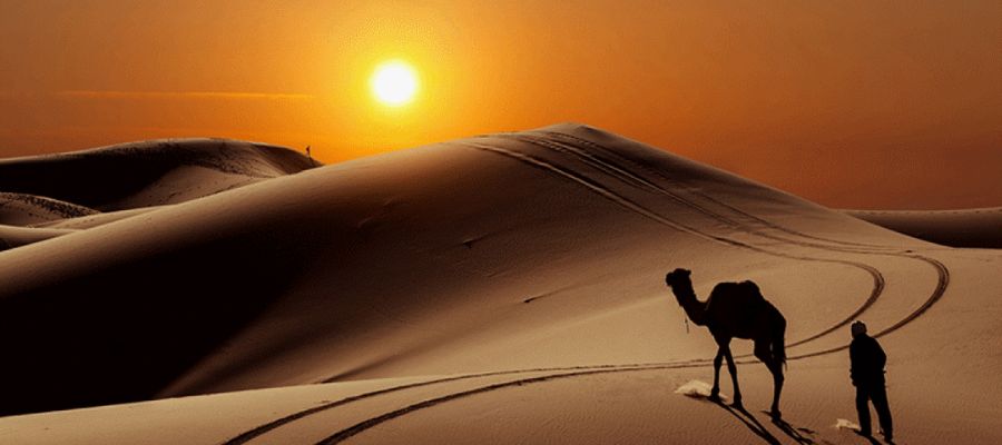
The dasht-e Kavir or Kavir e Namak is one of the largest and main deserts of Iran. This salty desert is situated in the center of the Iran plateau and covers an area of about 800 km (500 mi) by 320 km (200 mi). The dasht-e Kavir leads to the Alborz mountain range in the north, Qom and Kashan in the west, Pirhajat and Ozbakkooh mountain in the east, and Tabas in the south.
Climate and structure
There are some protected areas such as Damghan and Khartooran in this desert that are supervised by the Department of the Environment. In the west part of this place lies the Daryacheh-e Namak (Salt Lake). Kavir-e Namak is known as the hottest place in the world, temperatures can reach 50 °C (122 °F) in summer, and the average temperature in January is 22 °C (72 °F).
In the past, this land was covered by an ocean rich in salt. Over time, the underground salt layers tried to emerge through the mud and rocks and created the view of salt hills. This desert consists of salt marsh and mud. If a person falls into a salt hill may get stuck and be unable to escape. Due to this, the land is unpopulated except for the mountainous regions.
The dasht-e Kavir has hot and arid climates and completely barren soil. Only Common plant species like shrubs and grasses can be grown in some valleys and on mountain tops and mugwort is the most widespread plant. Some species like Persian Ground jay, Persian onager, and Asiatic cheetah live in some parts of this desert. But in mountain areas, wild sheep, camels, goats, and Persian leopards are common. Also, you can see the wild cats, wolves, foxes, and other carnivores at night. Lizards and snakes live on the central plateau.
Rig-e Jen
Rig-e Jen is one of the most impassable and mysterious regions in the world that is known as the Bermuda Triangle of Iran. This desert is located in the southwest and west of the Dasht-e Kavir which is the destination of many eco-tourists every year. This dangerous and scary desert has many quicksands that can lead visitors to death. Therefore, it is recommended to visit Rig-e Jen with a professional tour guide, full equipment, and food/ drink for two weeks.
Dasht-e Kavir desert tours
You can experience different trips and desert tours such as; desert trekking, long camel trekking, mountain biking, desert cycling, and desert safari. You can also enjoy sitting around the camp fire and listening to the southern Iranian music.
Kavir-e Lut
Kavir-e Lut (Lut desert) is one of the most untamed and beautiful places in Iran that tourists can visit. This desert is located in the southeast of Iran and covers a wide area of Kerman, Sistan and Baluchestan, and South Khorasan provinces. The area of the Lut desert is 480 km (300 mi) by 320 km (200 mi) which covers 10 percent of Iran’s extent.
Climate and structure
Kavire-e Lut is registered as the first natural phenomenon of Iran on the UNESCO World Heritage List. It has been recognized as the hottest spot on Earth in 2004, 2005, 2006, 2007, and 2009 also, in 2005, the temperature of this desert reached 70˚C. This desert due to its unevenness is divided into three geographical landforms: Northern Lut, central Lut, and Southern Lut.
The difference between day and night temperatures is noticeable in the Lut Desert but the presence of 120-day winds in summer makes the temperature not increase during the day and not increase at night.
Different parts of Kavir-e Lut
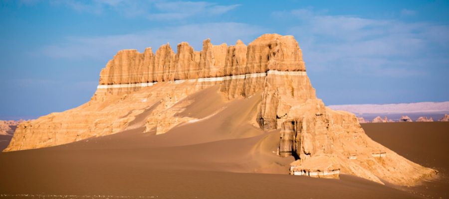
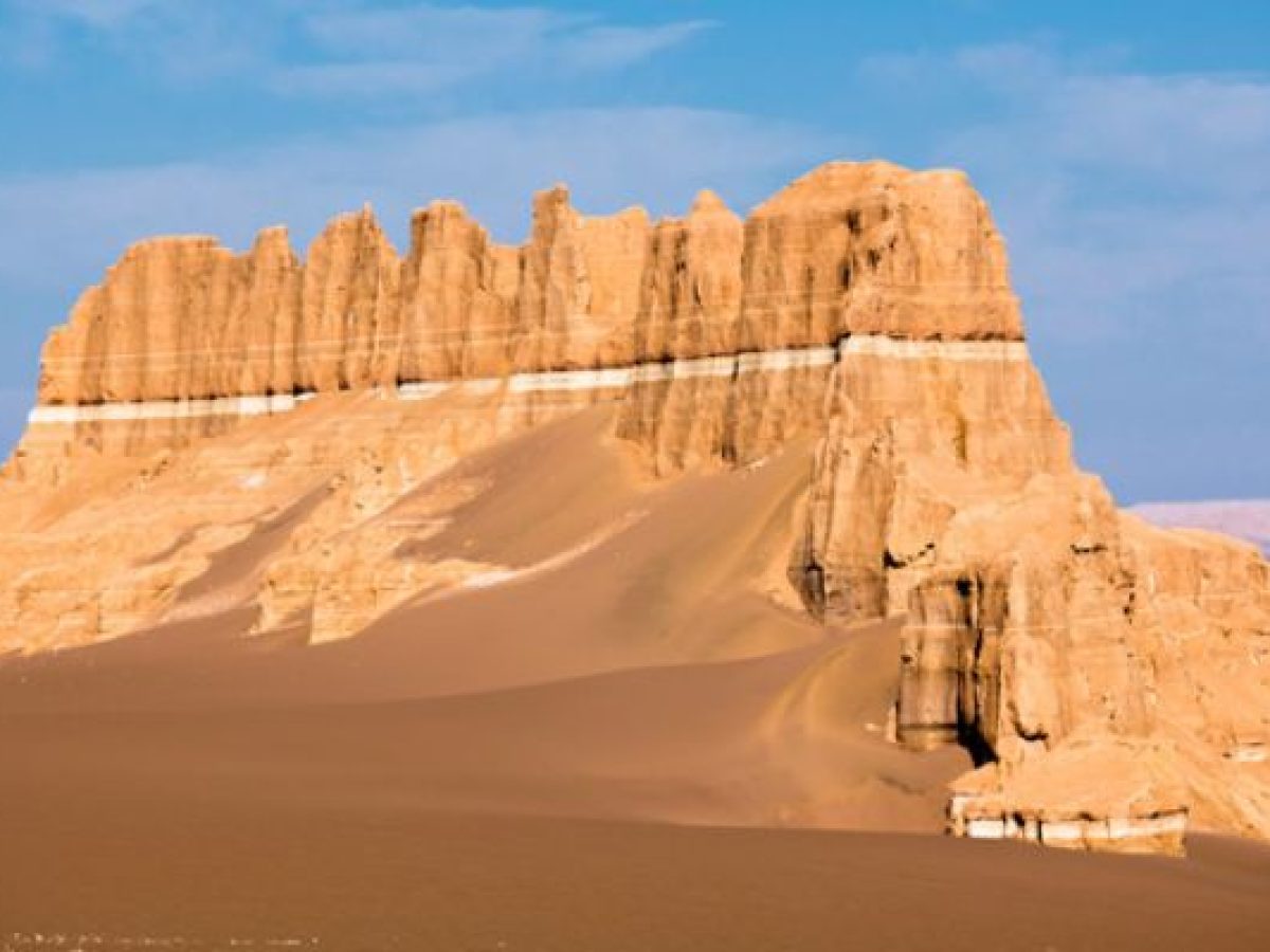
Northern Lut has mountains, sedimentary and volcanic hills; central lut is the most amazing part of Lut which is known as Chale Lut. This region is covered by dunes, salty deserts, and Kalts (Natural ridges in different forms resulting from the water, wind, and erosion mechanisms). This structure has caused numerous earthquakes in Northern Lut. The third landform is Southern Lut (Lut-e Zangi Mohammad) with the richest vegetation. Southern Lut is Geomorphology divided into three parts:
- Dasht Sar is known as desert pavement because it is covered with gravel and interlocking angular or rounded rocks without any vegetation.
- Kalut is an incomparable phenomenon and the main attraction of Lut that refers to deep ditches and massive sand pyramids that are formed by soil erosion.
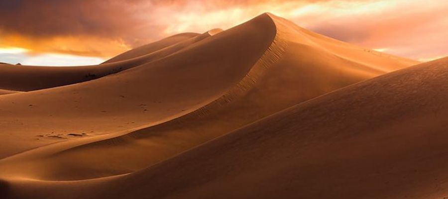
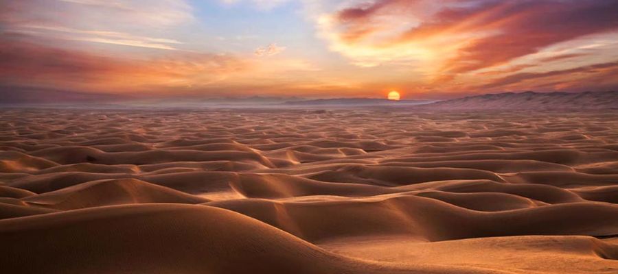
- Sand dunes have an area of 50,000 hectares and the height of some crescent hills is estimated up to 500 meters.
recreational activities
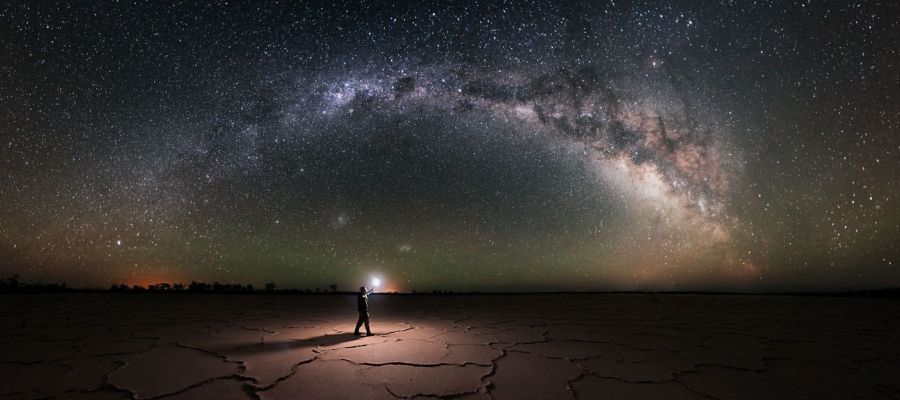
The amenities and recreation facilities in Kavir-e Lut are less than in the Dasht-e Kavir. You can enjoy the Safari and motorcycling, riding camel, hiking, photography, and watching the night sky of Lut which is attractive to astronomers and researchers.
Vegetation and fauna
The central regions of Lut are devoid of vegetation but, the Rig-e Yalan region has scattered vegetation that are sandstone plants such as stipagrostis plu,mosa, haloxylon and Calligonum comosum. Some animal species live in this desert such as; snakes, vulture birds, jaculus, foxes, and sand cats that are resistant to dehydration.